As summer heads towards Autumn, from my least enjoyable season to my most eagerly awaited season, photography wise, I planned to be out on two consecutive mornings, the first was to get to Crummock Water for an image that I wanted to re-capture in more pleasing conditions, and the second morning would be decided on later on in the day.
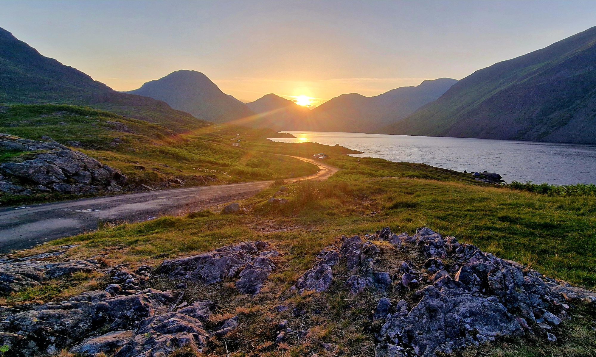
So, off to Crummock Water to get this shot in the can, but whilst driving thought he Lorton Valley the conditions were sublime, lovely low-lying mists which were hiding the trees and fells as it swirled around. What do I do, I wanted the shot at Crummock water, but these conditions were special. I had a parrot on each shoulder, should I go, or should I stay, OMG, why does this always happen. Decision made, I’m going to Crummock Water.
The car was parked, and I was loaded up with the camera, a couple of lenses and off I set through Lanthwaite Woods towards the lake, noting as I went how high the river was. This was due to the recent high rainfall that we have had recently, this not registering with me at this point, but it soon would.
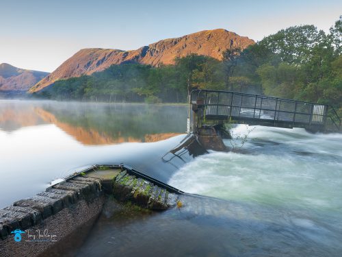
Upon arriving at the lakes edge, I looked over at the weir, and was surprised to see how high the water was, I needed to be on the other side of the river, which is navigated by crossing two small bridges across the lake outlet. As I made my way towards the first bridge, two lads were coming towards me, who asked where I was going, on hearing my plans to cross the bridges, the smiled and told me I don’t think you will be making it today. They were right, the water levels made it impossible to reach the bridges.
What a bloody fool I had been, so concentrated on the photo aspect of the morning and not giving any consideration to the recent amount of rainfall we have had ?
A little frustrated with myself, I took a wander around to see if there were any photos to be had, which would b any better than the existing ones that I have in my catalogue from this location. I ended up taking a couple, but knowing that these would not be any better.
Plan B stumbled into my head, lets get back to the valley where the mist was, so off I set retracing my route back to the car. Out of the car park we went heading back towards the village of Lorton where the earlier mists were. Again, I was frustrated to find that the rising sun had burned off nearly all the earlier mists, more frustration, what now.
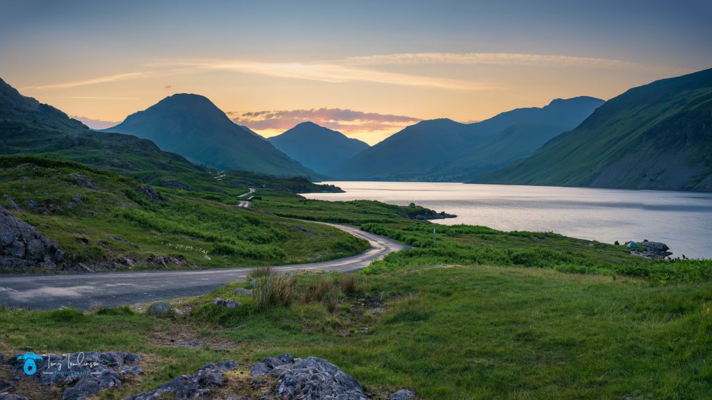
Plan C quickly materialised in my head, many years ago we had walked along Burbank fell above Loweswater, looking back towards Crummock Water and Buttermere in the far distance. I was quickly computing if this would be a feasible option, but in the confusion, I just set off in hope.
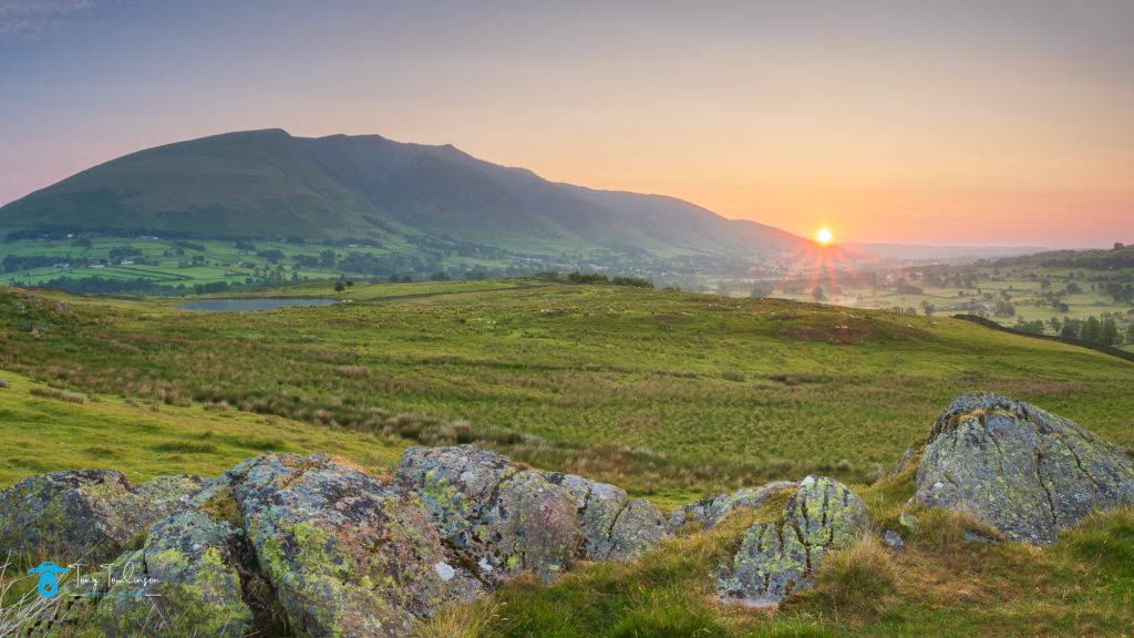
I turned off fangs brow and parked next to the footpath that would lead me to Burnbank Fell. I must admit, it was a pleasant walk, if not a little wet on the feet at times. As I crested the hill to get the view overlooking Loweswater, my mornings frustration continued, the sun was positioned just above the fells and glaring into the lakes surface, producing a ball of blinding light right across the lake. In these conditions it was impossible to get any image of Loweswater and Buttermere.
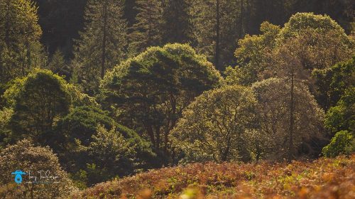
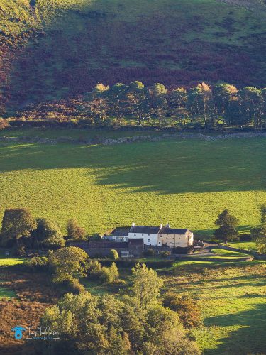
All that I could do was to pick out small aspects of interest looking north and westwards.
So, like earlier, I grabbed a couple of snaps and began to retrace my steps back to the car.
There was potential of some decent shots from Burnbank Fell, but later in the day or early evening when the sun would be in the opposite direction.
So, what was the plan to be for the second morning, I was hoping for similar misty conditions, and I was heading for Lorton Valley.
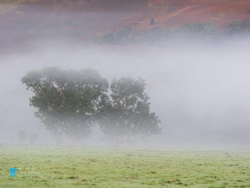
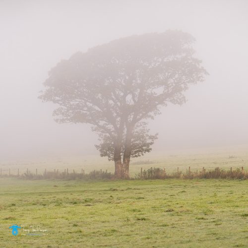
The next morning, the mists were again present in Lorton Valley, I was soon out of the car and tearing across fields looking for interesting woodland shots disappearing in the swirling mists.
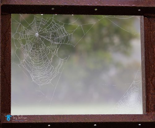
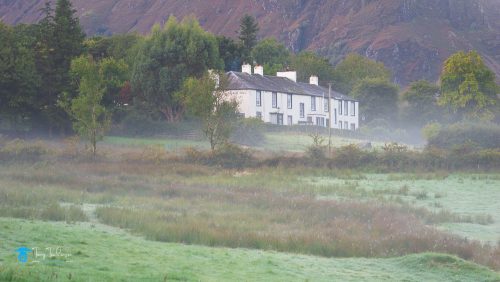
Then drive further along the valley to find a field with an old tractor, and several trailers in it, I stopped off to see if I could make anything of this situation. I spiders web coated in morning due which had been spun within a rusted steel frame. I got a shot of the Scale Hill Hotel on a hill intermingled with wisps of mist.
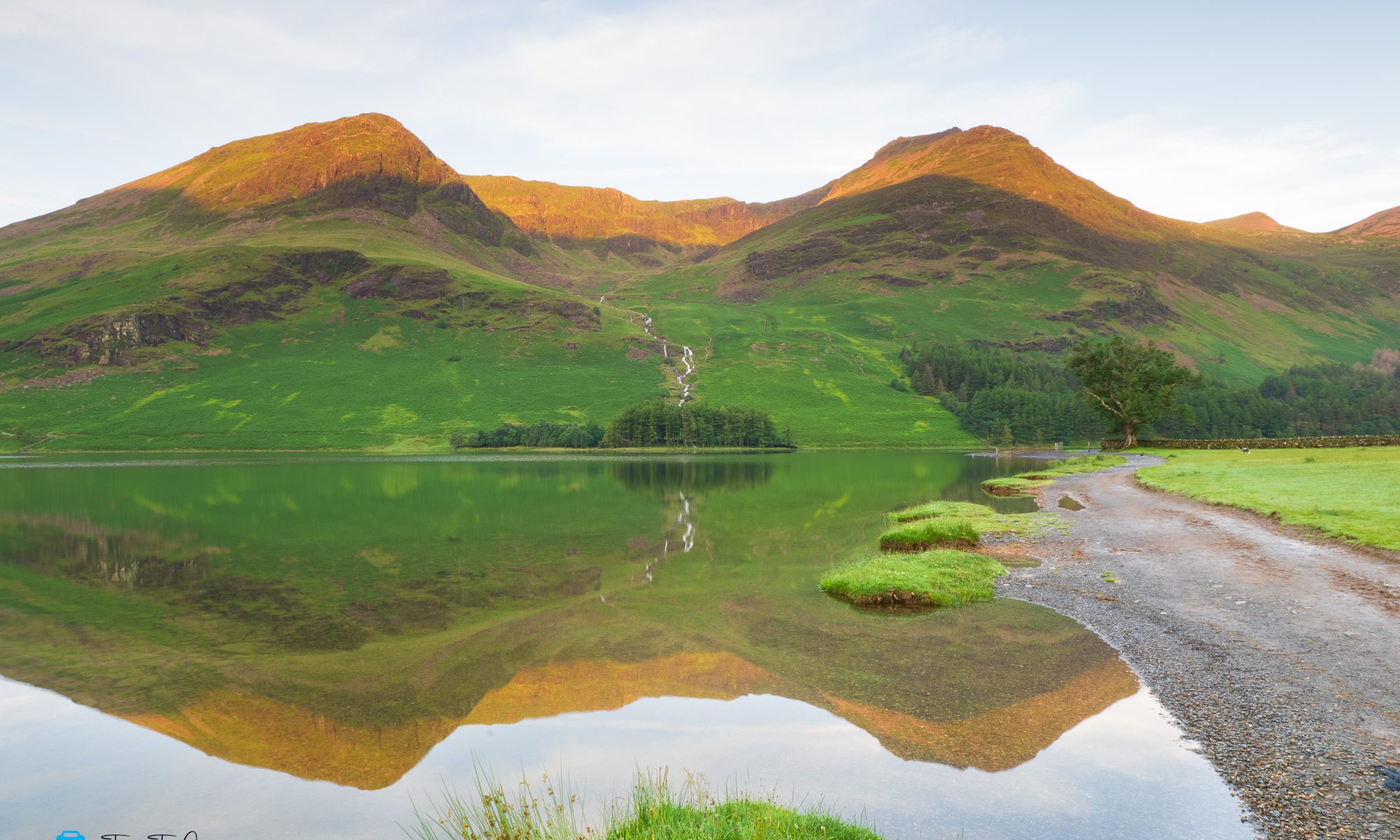
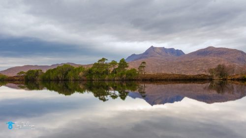
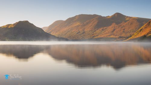
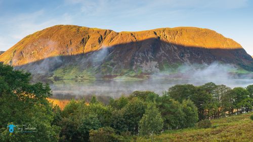
At this point the mist where I was began to disperse, probably due to the rising sun, so I decided to take a leisurely drive up to Buttermere to see if there was any mist around the lake, as I was passing Crummock Water, the rising sun was hitting the peaks of Mellbreak Fell, there being a few remaining wisps of mist circulating above the lake, so I stopped and grabbed a half decent image of the scene.
Once I arrived at Buttermere the conditions were rather harsh, no mist and an increasing breeze creating a disturbed waters surface, there was nothing more to do other than head home for some well-deserved breakfast.
I hope you enjoyed this short news article, until next time, stay safe?